
Aerial Technology and Advanced Digitization for Complete Data
At PG Arpentage, we’re at the forefront of technological innovation in construction surveying. Our drone, 3D scanning, and underground detection solutions are radically transforming the way you collect, analyze, and leverage data from your job sites.
By deploying 3D capture and analysis technologies that push the limits of what’s possible, we eliminate traditional obstacles, reduce risks for your teams, and considerably accelerate your project timelines. Every intervention is carefully planned to maximize coverage, precision, and safety.
Speak to a drone expert.
Drones and Aerial Surveys
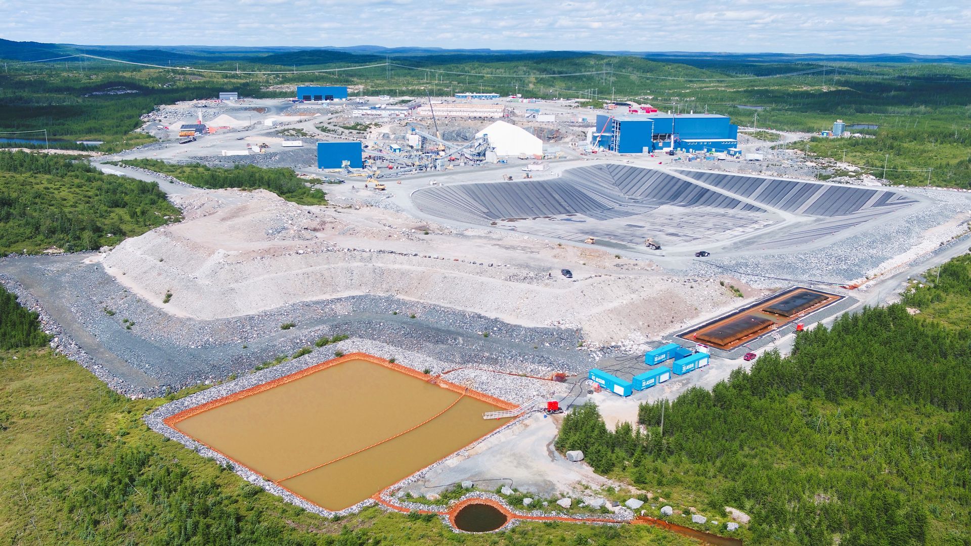
Use of UAVs equipped with high-performance sensors to quantify volumes, track progress, manage assets, and obtain precise aerial images of the job site.
Our drones allow us to obtain detailed topography, even in areas obstructed by vegetation or structures. Our aerial surveys integrate seamlessly with our other survey methods for complete coverage with no blind spots.
3D Modeling
Our detailed 3D models of terrain and structures facilitate the visualization, optimization, and planning of your projects. Integrating data from laser scanning, drones, GPS surveys, and photogrammetry, these models provide a complete, usable representation that anticipates any constraints, validates technical solutions, and improves communication among all stakeholders.
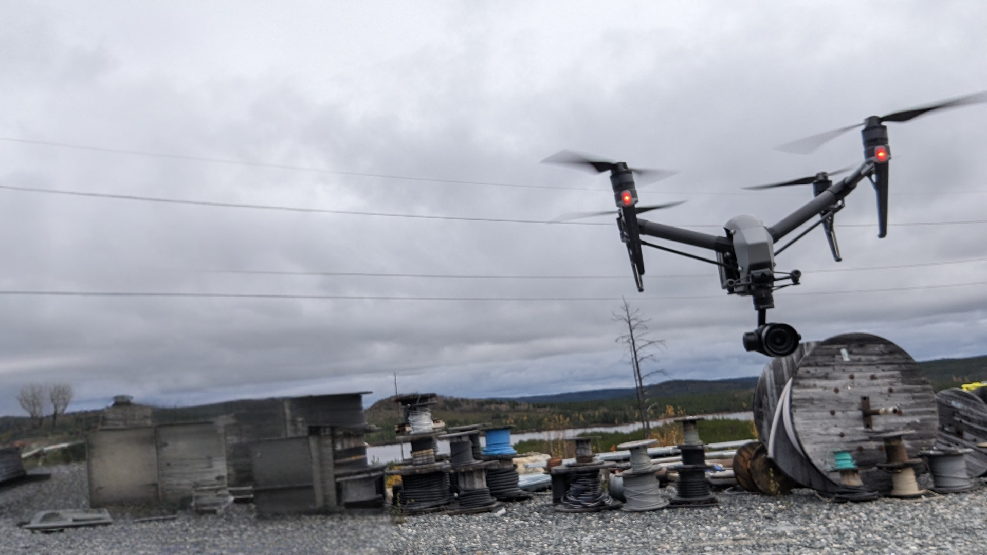
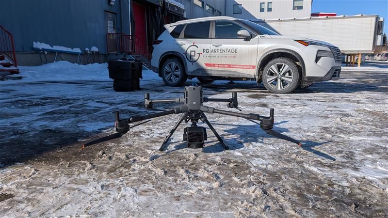
Drones
Our drones deployed on your job sites make it possible to carry out aerial surveys, volume calculations, and progress tracking quickly and reliably. Equipped with high-resolution cameras and LiDAR sensors, they access inaccessible areas and document your projects with centimetre-level precision.
Whether for topographic mapping, materials management, or progress monitoring, our UAVs reduce turnaround times, costs, and risks for your teams.
Drone Inspection
Drone inspection eliminates the risks associated with work at heights and in hazardous environments. Our UAVs inspect bridges, viaducts, rooftops, facades, industrial structures, and critical infrastructure without requiring scaffolding or production shutdowns.
Equipped with high-resolution cameras, thermal sensors, and advanced zoom capabilities, they detect cracks, deformations, thermal leaks, and anomalies with precision. Every inspection is documented with georeferenced images to facilitate analysis and intervention planning.
LiDAR
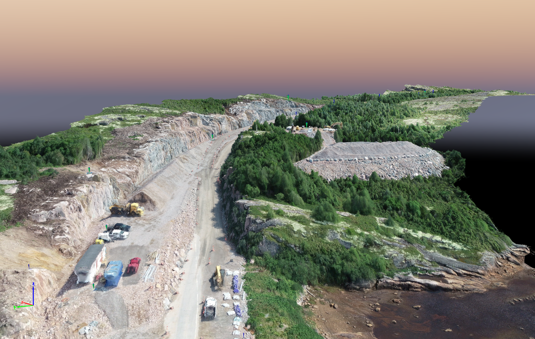
Our aerial and terrestrial laser scanning platforms capture high-density point clouds to create precise 3D models of your terrain and structures. LiDAR technology penetrates vegetation cover and maps the ground accurately, even in heavily wooded areas.
Combined with our ultra-HD cameras, it produces complete georeferenced data that serves as a reliable foundation for your analyses, designs, and verifications. We integrate these surveys with our other data acquisition methods to guarantee exhaustive coverage.
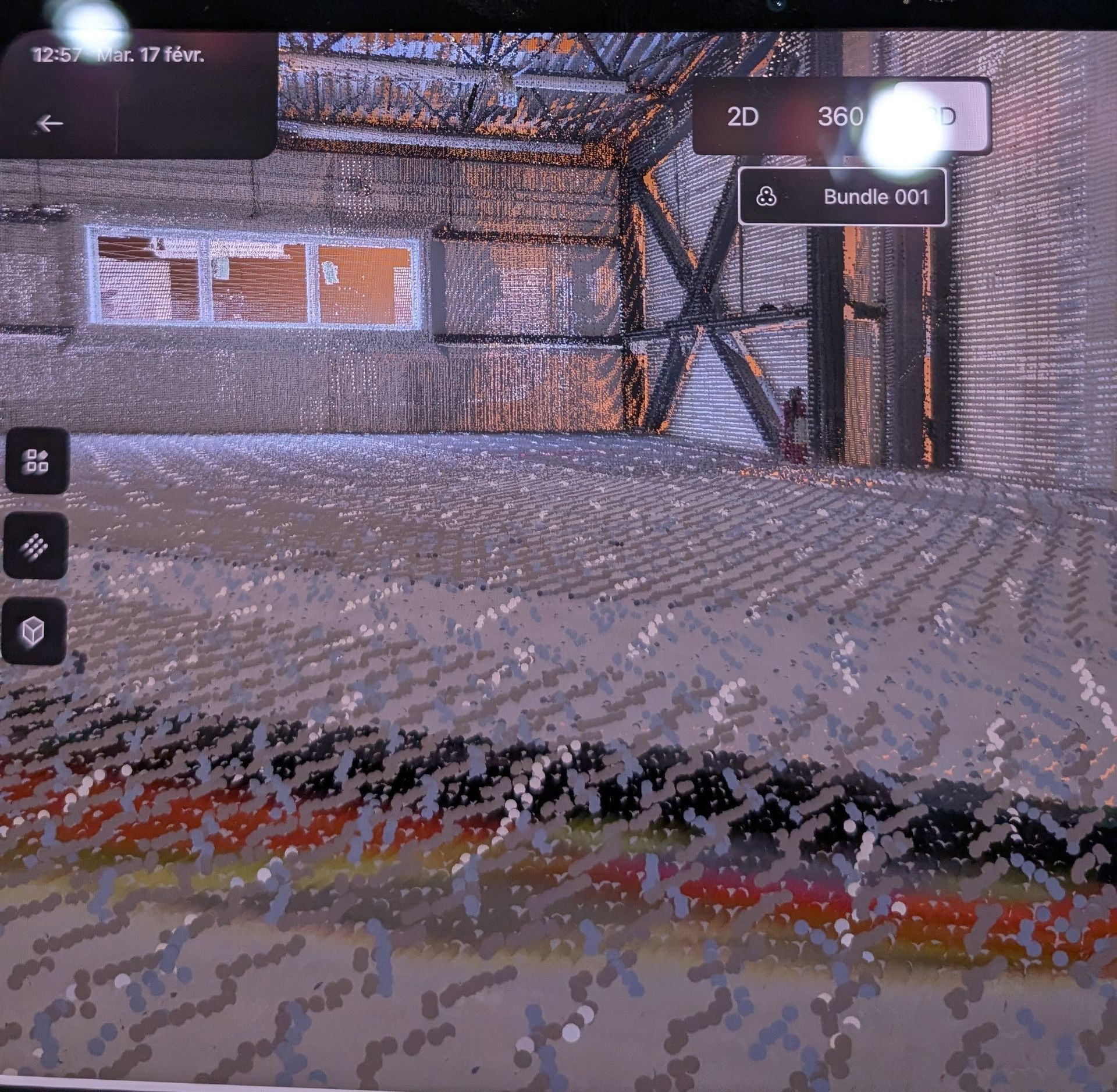
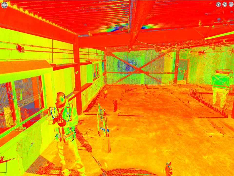
3D Scanning
Our 3D scanners capture millions of points in just minutes to faithfully reproduce terrain, buildings, and complex infrastructure. This technology measures the flatness of surfaces with pinpoint accuracy, locates specific elements, and documents the progress of work.
3D scanning reduces the required presence on site, accelerates decision-making, and generates a permanent database that can be exploited for design, technical verification, and final documentation. The data obtained is compatible with BIM environments and the industry's main software platforms.
Terrestrial Laser Scanning
Ultra-precise measurement of surfaces (floor and wall flatness, element location, progress tracking) using 3D laser scanning technology.
Our 3D scanners capture millions of points in just minutes, providing exhaustive and permanent documentation of your job site. This approach reduces the need for extended on-site presence and accelerates decision-making by providing data of unmatched precision.